
搜索结果: 1-15 共查到“Road”相关记录84条 . 查询时间(0.637 秒)

Humans may be one of the biggest roadblocks keeping fully autonomous vehicles off city streets.
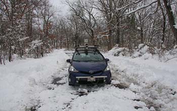
Researchers look under the road to aid self-driving cars(图)
Researchers road aid self-driving cars
2020/3/6
Car companies and researchers have been feverishly working to improve the technologies behind self-driving cars. But so far, even the most high-tech vehicles still fail when it comes to safely navigat...
ROAD NETWORK MAPPING USING AIRBORNE LiDAR DATA
Road Airborne Laser Scanning (ALS) Intensity
2019/2/28
The accurate, detailed and up-to-date road information is highly essential geo-spatial databases for transportation, smart city and other related applications. Thus, the main objective of this researc...
EXPLORATION ON QUANTIFYING CARBON DIOXIDE (CO2) EMISSION FROM ROAD TRAFFIC IN MEGACITY
CO2 emissions Vehicle emissions Traffic census
2018/11/9
As the increasing concern for climate change, quantification on greenhouse gas (GHG) emissions in urban scale has been a key component for local climate actions. To explore an approach on estimating t...
COMBINED VISUAL EXPLORATION OF 2D GROUND RADAR AND 3D POINT CLOUD DATA FOR ROAD ENVIRONMENTS
Ground Penetrating Radar 3D Point Cloud Infrastructure Maintenance
2018/11/9
Ground-penetrating 2D radar scans are captured in road environments for examination of pavement condition and below-ground variations such as lowerings and developing pot-holes. 3D point clouds captur...
THE RESEARCH AND EVALUATION OF ROAD ENVIRONMENT IN THE BLOCK OF CITY BASED ON 3-D STREETSCAPE DATA
3D streetscape data block unit urban assessment model street environment traffic environment urban plan
2018/5/14
This paper focus on the problem of the street environment of block unit, based on making clear the acquisition mode and characteristics of 3D streetscape data,the paper designs the assessment model of...
2017机器人重复性研究研讨会(Workshop on Reproducible Research in Robotics: Current Status and Road Ahead)
2017 机器人 重复性研究 研讨会
2017/5/23
In Robotics research the replicability and reproducibility of results and their objective evaluation and comparison is very difficult to put into practice. Controlling for environmental consideratio...
“一带一路”大数据论坛暨2017大数据时代的智慧交通与物流国际会议暨第五届国际决策科学高峰论坛(Big Data Forum on“One Road, One Belt” 2017 International Conference on Intelligent Transportation and Logistics with Big Data & The Fifth International Forum on Decision Sciences)
一带一路大数据 论坛 2017 大数据时代的智慧交通与物流 国际会议 第五届 国际决策科学 高峰论坛
2017/3/9
2017大数据时代的智慧交通与物流国际会议(2017 International Conference on Intelligent Transportation and Logistics with Big Data, ICITL-BD) 暨第五届国际决策科学高峰论坛 (The Fifth International Forum on Decision S...
Yesterday's Silk Road could be tomorrow's environmental superhighway
Yesterday's Silk Road tomorrow's environmental superhighway
2016/11/29
While China is building a gigantic modern-day upgrade of the famed ancient Silk Road resplendent in global cooperation in the name of economic expansion, a group of sustainability scholars point out t...
AUTOMATIC ROAD EXTRACTION FROM LIDAR DATA BASED ON CLASSIFIER FUSION IN URBAN AREA
LIDAR Road Extraction Classifier Fusion Classifier selection Genetic Algorithm
2016/2/29
LIDAR is a powerful remote sensing technology for acquisition of 3D information from terrain surface. Algorithms used for LIDAR
data in urban area are used mostly to deal with the 3D points cloud an...
Road Tax on Truck Traffic with Environmental Aspects
EURO standard Negative externality Road tax
2016/1/27
The contribution deals with issues of taxation of truck traffic in the Czech Republic and European Union countries. The article discusses the current need for the introduction of environmental feature...
Extracting of Spatial Information in the Environment of Irish Road Using Airborne Laser Scanning
LiDAR (Light Detection and Ranging) Noise Classification Object Extraction Orthophotos Roads
2015/12/8
This paper describes the first phase of a three year PhD research project which aims at extracting road and roadside information accurately and robustly from airborne sensor data and assessing its sui...
Using Road Pavement Markings as Ground Control for LIDAR Data
LiDAR LiDAR intensity Feature extraction QA/QC
2015/11/20
LiDAR technology, the primary source of highly accurate surface data at large scale, has seen remarkable developments in recent years. Specifically, the accuracy of the laser ranging has reached the f...
AUTOMATIC DETECTION OF PATTERNS IN ROAD NETWORKS -METHODS AND EVALUATION
pattern recognition networks vector data geometric information
2015/9/28
Spatial data play a major role in many areas. They are an important source of information for a wide range of applications. The
quality and quantity of data have increased in the last decades, resul...
The Road to Pell is Paved with Good Intentions: The Economic Incidence of Federal Student Grant Aid
Good Intentions Federal Student Grant Aid
2015/9/24
The federal Pell Grant Program provides billions of dollars in subsidies to low-income college students
to increase a
ordability and access to higher education. I estimate the economic incidence of t...