搜索结果: 1-15 共查到“信息与通信工程 Data”相关记录286条 . 查询时间(0.296 秒)
Academy of Mathematics and Systems Science, CAS Colloquia & Seminars:Optimization problem in remote sensing data processing
遥感 数据处理 优化问题
2023/5/4
Academy of Mathematics and Systems Science, CAS Colloquia & Seminars:A literature review in tourism research based on big data
大数据 旅游研究 文献综述
2023/5/18

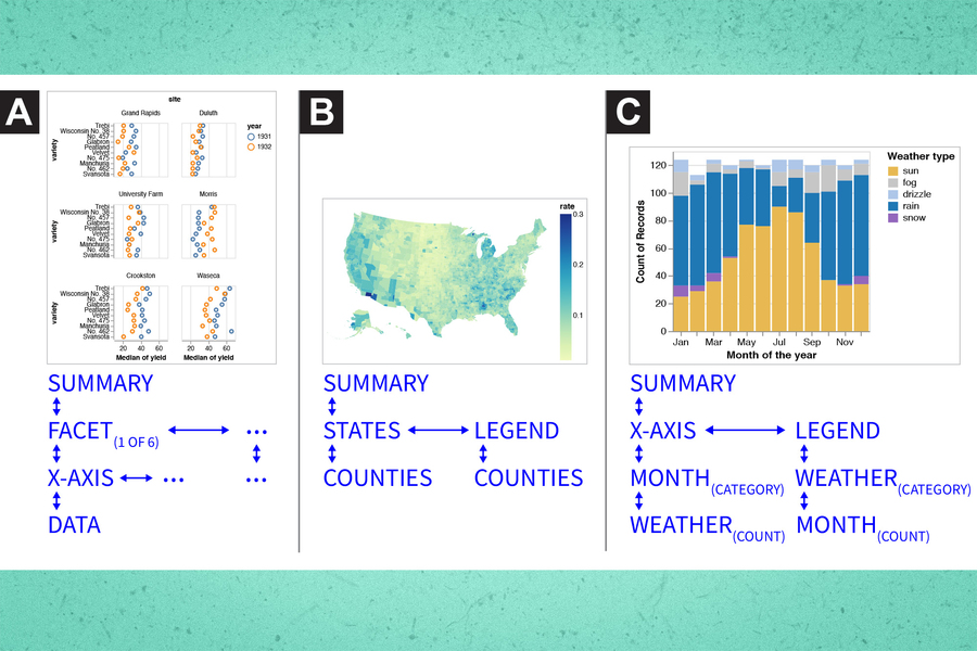
Making data visualization more accessible for blind and low-vision individuals(图)
盲人 低视力人士 数据可视化
2023/6/20

Estimating the informativeness of data(图)
数据 信息量 人工智能
2023/6/20

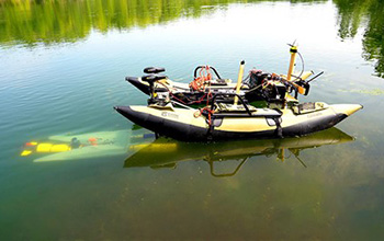
What if underwater robots could dock mid-mission to recharge and transfer data?(图)
underwater robots dock mid-mission recharge transfer data
2020/10/23
Robots can be amazing tools for search-and-rescue missions and environmental studies, but eventually they must return to a base to recharge their batteries and upload their data. That can be a challen...
上海财经大学信息管理与工程学院数据挖掘课件 Data Mining with R(Codes)
上海财经大学 信息管理与工程学院 数据挖掘 课件 Data Mining with R
2019/7/24
上海财经大学信息管理与工程学院数据挖掘课件 Data Mining with R(Codes)。
上海财经大学信息管理与工程学院数据挖掘课件 Data Mining with WEKA
上海财经大学 信息管理与工程学院 数据挖掘 课件 Data Mining with WEKA
2019/7/24
上海财经大学信息管理与工程学院数据挖掘课件 Data Mining with WEKA。
上海财经大学信息管理与工程学院数据挖掘课件 Data Preprocessing。
上海财经大学信息管理与工程学院数据挖掘课件 Learning from Data。
上海财经大学信息管理与工程学院数据挖掘课件 Exploring Data。
上海财经大学信息管理与工程学院数据挖掘课件 Introduction to Data Mining
上海财经大学 信息管理与工程学院 数据挖掘 Introduction to Data Mining
2019/7/24
上海财经大学信息管理与工程学院数据挖掘 Introduction to Data Mining。
3D DATA PROCESSING TOWARD MAINTENANCE AND CONSERVATION. THE INTEGRATED DIGITAL DOCUMENTATION OF CASA DE VIDRO
3D Integrated Survey Documentation Point cloud processing and analysis
2019/3/1
During the last decade, 3D integrated surveys and BIM modelling procedures have greatly improved the overall knowledge on some Brazilian Modernist buildings. In this framework, the Casa de Vidro 3D su...
A COMPARATIVE STUDY OF LAND SURFACE TEMPERATURE WITH DIFFERENT INDICES ON HETEROGENEOUS LAND COVER USING LANDSAT 8 DATA
LST Landsat 8 NDBI NDSI NDVI NDWI Land Cover
2019/2/27
The temperature rise in urban areas has become a major environmental concern. Hence, the study of Land surface temperature (LST) in urban areas is important to understand the behaviour of different la...
ROAD NETWORK MAPPING USING AIRBORNE LiDAR DATA
Road Airborne Laser Scanning (ALS) Intensity
2019/2/28
The accurate, detailed and up-to-date road information is highly essential geo-spatial databases for transportation, smart city and other related applications. Thus, the main objective of this researc...
GIS AND BIM INTEGRATION AT DATA LEVEL: A REVIEW
GIS BIM CityGML IFC data Integration models
2018/11/9
City Geography Markup Language (CityGML) and Industry Foundation Class (IFC) are the two most popular data exchange format for the integration of Geographic Information System (GIS) and Building Infor...


